on
John Muir Trail 2019: Week 2
Week 2: Bishop Pass to Kearsarge Pass
Day 9: LeConte Canyon to Dusy Basin to LeConte Canyon
No sooner had I stepped out of my tent than a passing hiker hailed me.
“Hey, just so you know, there’s a very large black bear about three minutes down the trail.”
I thanked him for warning me, wondering how close my ursine neighbor may have come to my tent in the middle of the night. I had planned to take a zero day while I waited for my friend Matt to hike in from South Lake, over Bishop Pass, and down to the JMT. With the bear so close, I decided I could stretch my legs and hike up to meet him in Dusy Basin after all.
Sure enough, not two minutes down the trail I came across the bear wandering around the slabs just off the trail. He continued to flip over rocks as he had done the previous afternoon. I guess that’s just what he does.

Morning bear sighting
With extra encourgement of a nearby bear, I hustled up the switchbacks, working my way quickly out of the canyon. The trail here is very well constructed, as it serves as a major access point to the JMT from the high trailhead at South Lake.
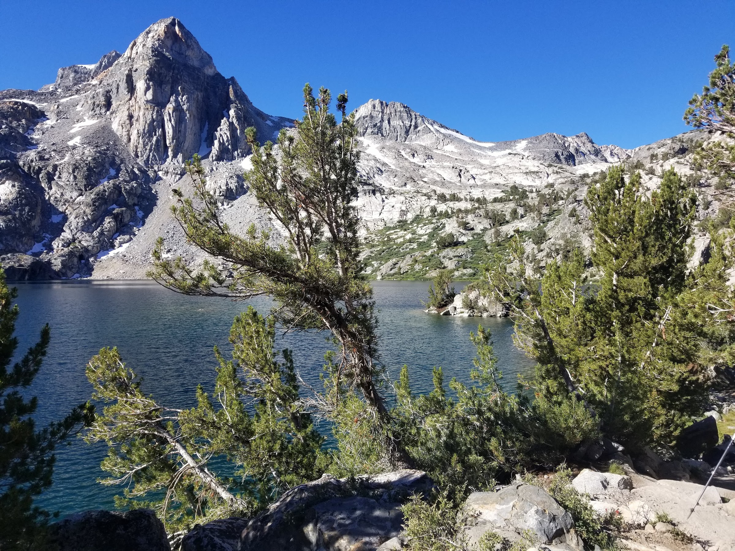
An hour or two later, I found myself in the picturesque Dusy Basin, with the airy summits of the Palisade crest towering over me. The mosquitos were bad here, it would have been brutal without a head net. On my way up towards Bishop Pass, I noticed a bright flash of color. Over a rise came a walking whitewater kayak. As it got closer, I noticed the man struggling underneath it. He took a break as I approached and I struck up a conversation. He and his three buddies were hauling their fifty pound kayaks, along with four days of food and camping equipment, from South Lake and down to the Middle Fork of the Kings. They would run the Class V whitewater all the way down, past the junction of the forks of the Kings in the touristy part of the park, all the way to Pine Flat Reservoir above Fresno. Sick!

The Palisades from Dusy Basin
I decided to break for lunch as it was near noon. Not five minutes after I stopped did I noticed a tall hiker carrying a bright red pack approaching at a fast clip. It was Matt! My hello was awkward - turns out that being alone for eight days straight made me much more talkative than my normal disposition.
Lunch consumed, we made our way back down to the JMT junction. The bear had left my camp undisturbed. We briefly considered staying, but the (omni-)prescence of the bear encouraged us to do an “extra mile” to give us some buffer from his terrority. Our extra mile turned in to about three before we final set camp.
As we were cooking dinner, we heard a commotion on the river. The kayakers had put in and floated a few miles down to reach us. They were pulling up to scout out a small waterfall. Having rafted a few Class IV rivers with a guide, I thought they would portage around. Instead they flashed us a shaka and ran the fall successfully.
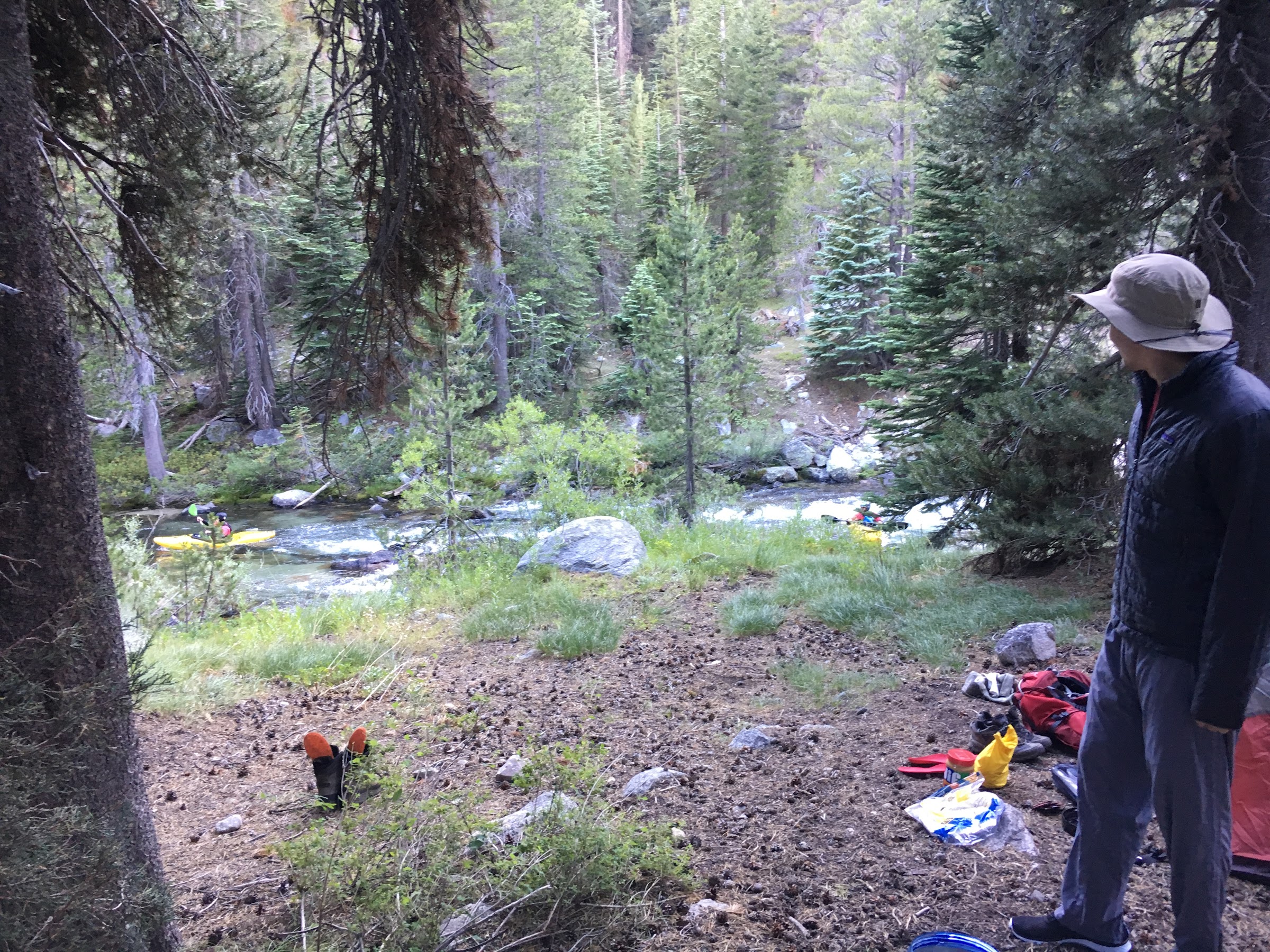
Kayak bros paddling past our camp along the Middle Fork Kings
Day 10: LeConte Canyon to Upper Basin
Despite the fact that Matt hiked in the day before, we had plans to cross the 12,000 foot Mather Pass. Before we reached the pass, we first had to ascend the canyon of Palisade Creek. The early part of this hike carried us through lush vegetation and felt much different from the high alpine basins of the previous few days. Soon enough we ascended the “Golden Staircase” up out of the canyon to reach the Palisade Lakes. After Evolution and Dusy Basins, I found this area to be pleasant but underwhelming.

Working our way up to Mather Pass past Lower Palisade Lake
From the lakes we played our new favorite game: “Where’s the Pass?”. The tiny gap high on the divide ahead of us turned out to be Mather Pass, but we still had a good hour of hard uphill hiking before we reached it. As the trailed ascended towards the pass, it became rockier and more rugged, crossing over a few tricky stretches of snow. Thankfully the boot pack was established here.
Eventually we reached the gap and were rewarded with a view down to Upper Basin. I found Mather Pass to be much more difficult than Silver, Selden, or Muir. The combination of high elevation and rough terrain surely contributed to its difficulty. From the pass we headed down the very exposed and steep switchbacks on the south side before the trail leveled out. We struck out cross-country, aiming for Lake 11,597 at the foot of Split Mountain. We were surprised to find another party camped here; apparently the fish were biting in the lake!

Camp in Upper Basin below Split Mountain
Day 11: Upper Basin to South Fork Kings River
The night was cold up here at 11,500’ and we were chilly when we awoke and got ready to tackle Split Mountain. The route took us around the south shore of the lake over easy terrain and up a set of grassy slopes to the east. Matt and I debated the meanings of “heath” and “moor” and decided that either would be appropriate to describe the area over which we traveled.
Eventually, the grass gave out and we began a climb over talus. When we reached the saddle between Split and Mount Prater, we could see down into the Owens Valley. This was the first time I had seen civilization (besides Muir Trail Ranch) in over ten days. From the saddle we still had about 1,500 feet of climbing up increasingly unstable talus. It took awhile and our conversation became more profanity laden as we climbed, but we eventually reached the summit, happy to have tagged 14,000 feet.
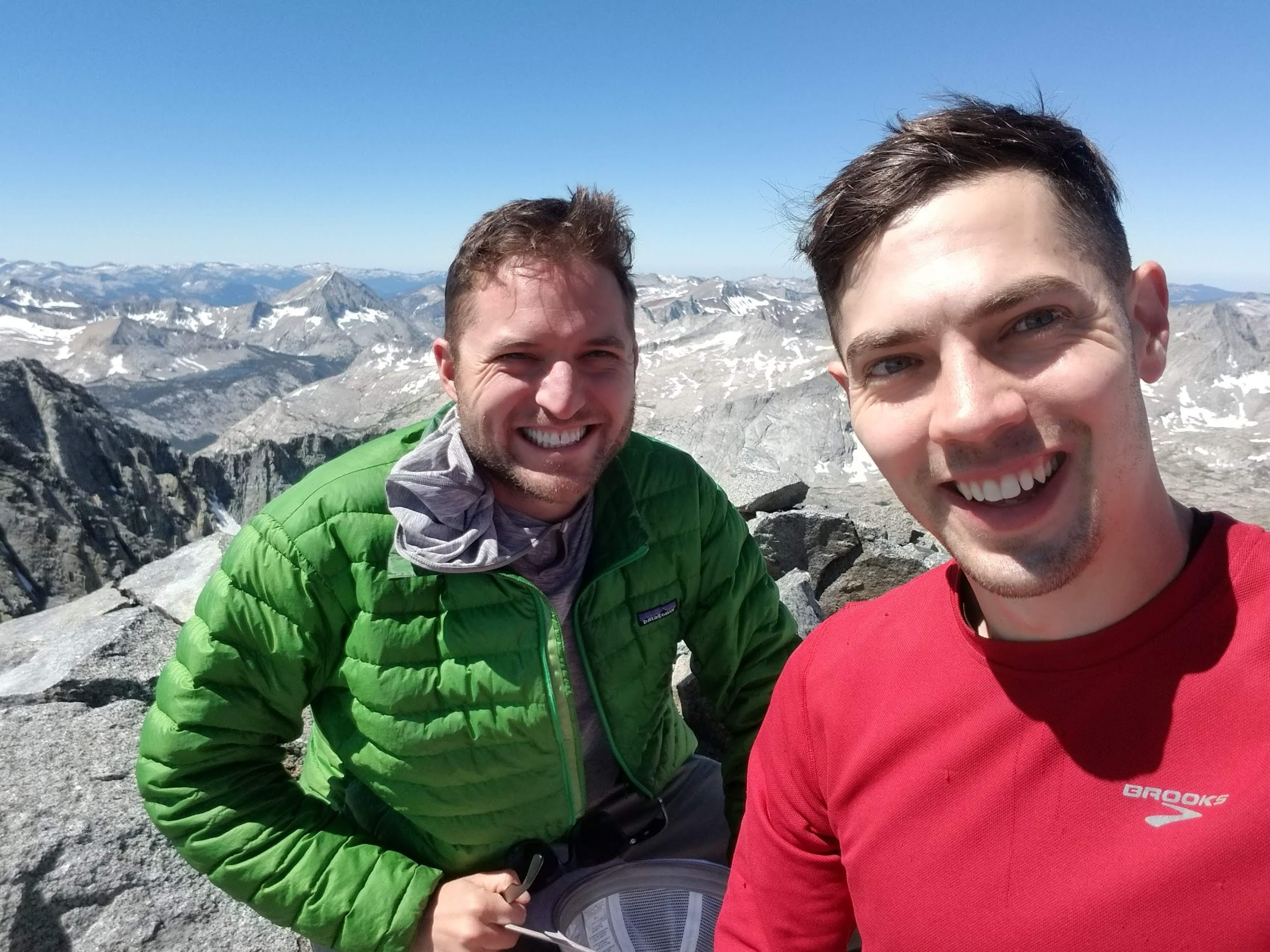
Ethan and Matt on the summit of Split Mountain
The rest of the day was pleasant. We descended easily, packed up camp, and headed down the beautiful terrain of Upper Basin and the headwaters of the South Fork Kings River. I had read that the South Fork crossing down canyon can be tricky in high water, but from where we stood, the river was small and given how overblown the previous creek crossings had been, we opted to stay on the JMT proper and skip the detour high to the east as some guidebooks suggest. Camp was made just below treeline.

Magnificent Upper Basin looking south towards Pinchot Pass
Day 12: South Fork Kings River to Dollar Lake
We had grand climbing plans for this day, with a number of peaks just a short distance off the trail. But before we reached them, we had to cross the South Fork of the Kings River and climb Pinchot Pass. The South Fork turned out to be an easy wade, and the climb from there up to Pinchot Pass was gentle and serene. I was struck by how different each of the passes had been.

Ethan and Matt at Pinchot Pass
From Pinchot we surveyed possible climbs of Mount Pinchot, Mount Wynne, Mount Perkins, or Colosseum Mountain. All of the mountains in this area are huge piles of talus and we weren’t feeling any of them. So we decided to press on, aiming to motor all the way to Rae Lakes area to give us more time to climb in that vicinity.
After hiking down Woods Creek drainage for what seemed an eternity, we finally reached the infamous suspension bridge. It was very bouncy, far more so than similar bridges I had used in Nepal. It held, and we were confronted with a huge number of backpackers on the south side of the creek. We had met up with the Rae Lakes Loop, a classic three-to-four day backpacking loop popular with beginners.
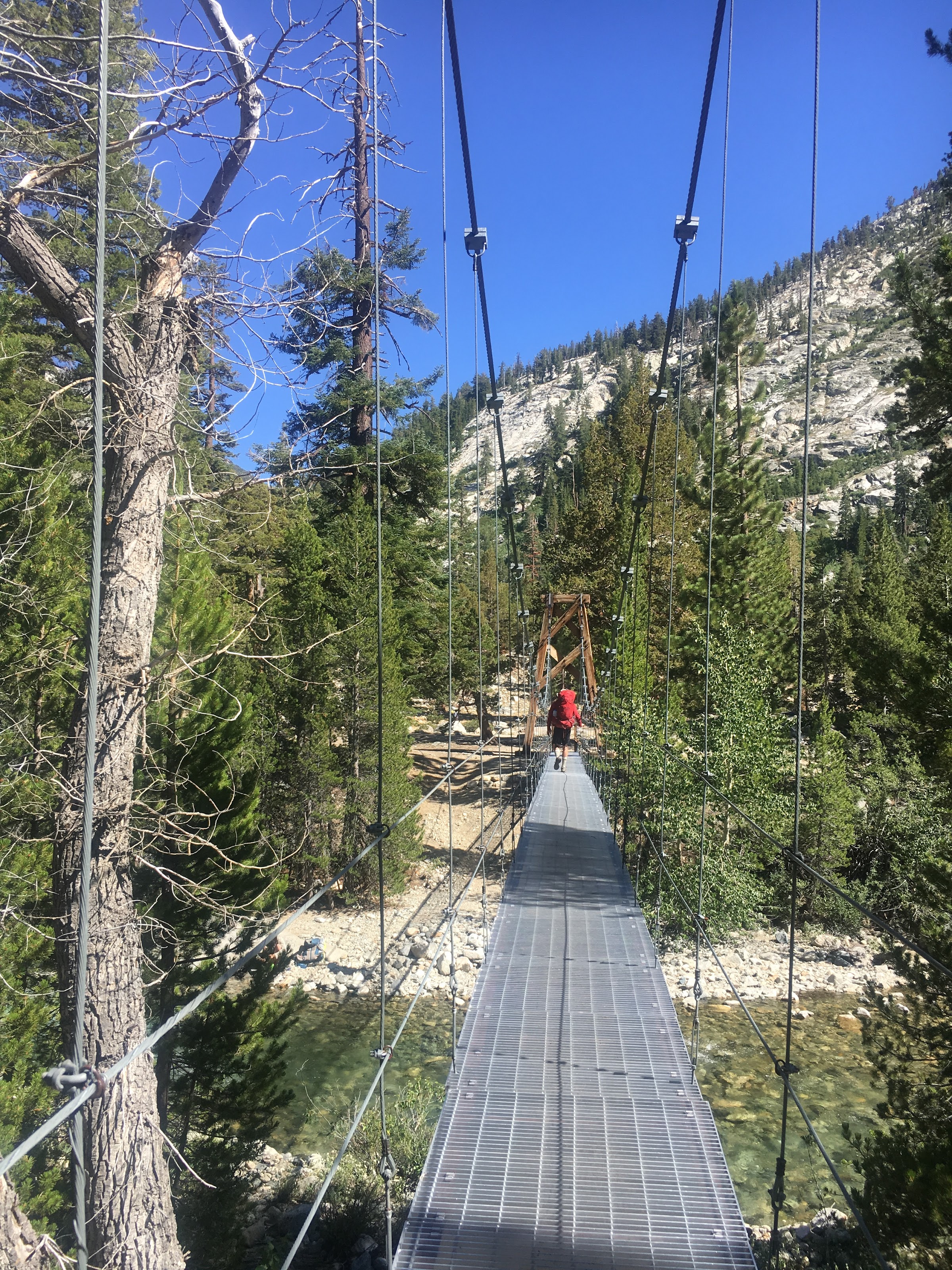
Matt crossing Woods Creek
We were tired at this point, having already hiked over ten miles and crossed a high pass, but we pressed on, climbing another 1,500 feet up to the Dollar Lake area before setting up camp. The sunset on Fin Dome and the high peaks of this area was stunning.
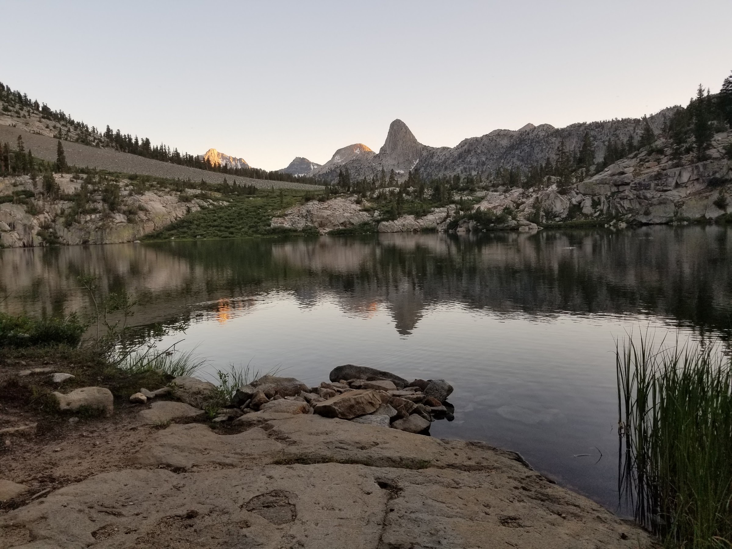
Last light on Fin Dome from our camp near Dollar Lake
Day 13: Dollar Lake to Charlotte Lake
We got an early start, hoping to cross Glen Pass in the morning and climb Mount Bago near Charlotte Lake in the afternoon. The Rae Lakes basin was nice, but not my favorite of the alpine basins. It was here that we met our first ranger on the trail who checked our permits. High Sierra rangers live for the entire summer in a series of remote cabins scattered along the JMT corridor. What a lifestyle!
Painted Lady above one of the Rae Lakes
Glen Pass was a tough ascent for me and we took a long break on the top of the pass. I was feeling the effects of my calorie-restricted diet at this point and was very thankful for Matt’s extra M&Ms as a supplement for my meager stores. The drop of the south side of Glen is steep and jarring, falling 2,000 feet in just over a mile.

Hikers ascend Glen Pass
We set up camp in the warm afternoon soon at the east end of Charlotte Lake and surveyed the route up Mount Bago. This peak has two distinct summits, one comprised of red rock and one of gray. The gray is the higher, but we climbed a line of solid rock up the red and then traversed across an unexpected plateau over to the higher gray summit.
This summit was so cool! Despite being far shorter than basically every surrounding peak, it is centrally located and commands a stunning view down Kings Canyon to the west and into Center Basin to the south. We spent a long time here trying to match the peaks we could see against our map.

Taking in the view from the summit of Mount Bago
Day 14: Charlotte Lake to Gilbert Lake
Day 14. We had enough food for one more night in the backcountry and there we still peaks to climb, so we set our sights on nearby Mount Rixford. Secor says “Class 1 from Bullfrog Lake”, so we walked up trail until we were above Bullfrog lake and took off up the slope. Bad move. The south face of this mountain is 2,000 feet of garbage. Loose talus, miserable scree, you name it. Near the top, we hit a false summit, had to traverse a narrow ridge above a snow field, and then climb our way up a very steep, very loose Class 2 chute to the summit. I took a nap at the top.

A well-deserved nap on the summit of Mount Rixford
From the summit it was obvious that we climbed too far to the west. The southeast slopes follow a wide gully down to a creek over nice scree. We descended in about thirty minutes what had taken us over two hours to climb. After quenching our thirst and spending some time out of view of the baking sun, we picked our way up trail to Kearsarge Pass. There were about twenty people milling about the top here in an odd combination of block party and medical clinic. We didn’t linger.
We headed down the very well built Kearsarge Pass trail, making it to within a few miles of the trailhead. Our motel reservation was for the following night, so we set up camp near Gilbert Lake and relaxed. I made the mistake of brushing up against a tree without bark, covering my pants in sap and forcing the rest of my afternoon to be taken up with laundering the pants as best I could. It was time to head back to civilization.

Headed back to civilization via Kearsarge Pass
Day 15: Gilbert Lake to Onion Valley
We awoke before six, skipped breakfast, and hiked the fastest we had all trip. The three miles to the trailhead flew by, and before we knew it, we were at the car and back in Lone Pine. Breakfast time!
comments powered by Disqus