on
John Muir Trail 2019: Week 3
Week 3: Kearsarge Pass to Mount Whitney
Day 16: Onion Valley to Center Basin
We awoke refreshed and clean from our night spent at the Dow Villa Motel in Lone Pine. After fueling up on amazing food at the Alabama Hills Cafe, we loaded the car and headed back into the mountains to Onion Valley. We quickly retraced our steps up to Kearsarge Pass, climbing quickly, invigorated by a day of rest and refueling.
From the pass, we followed the lower trail past Bullfrog Lake, shimmering in the midday sun. We reconnected with the JMT and headed steeply downhill to Bubbs Creek and Vidette Meadow.
Bullfrog Lake in the midday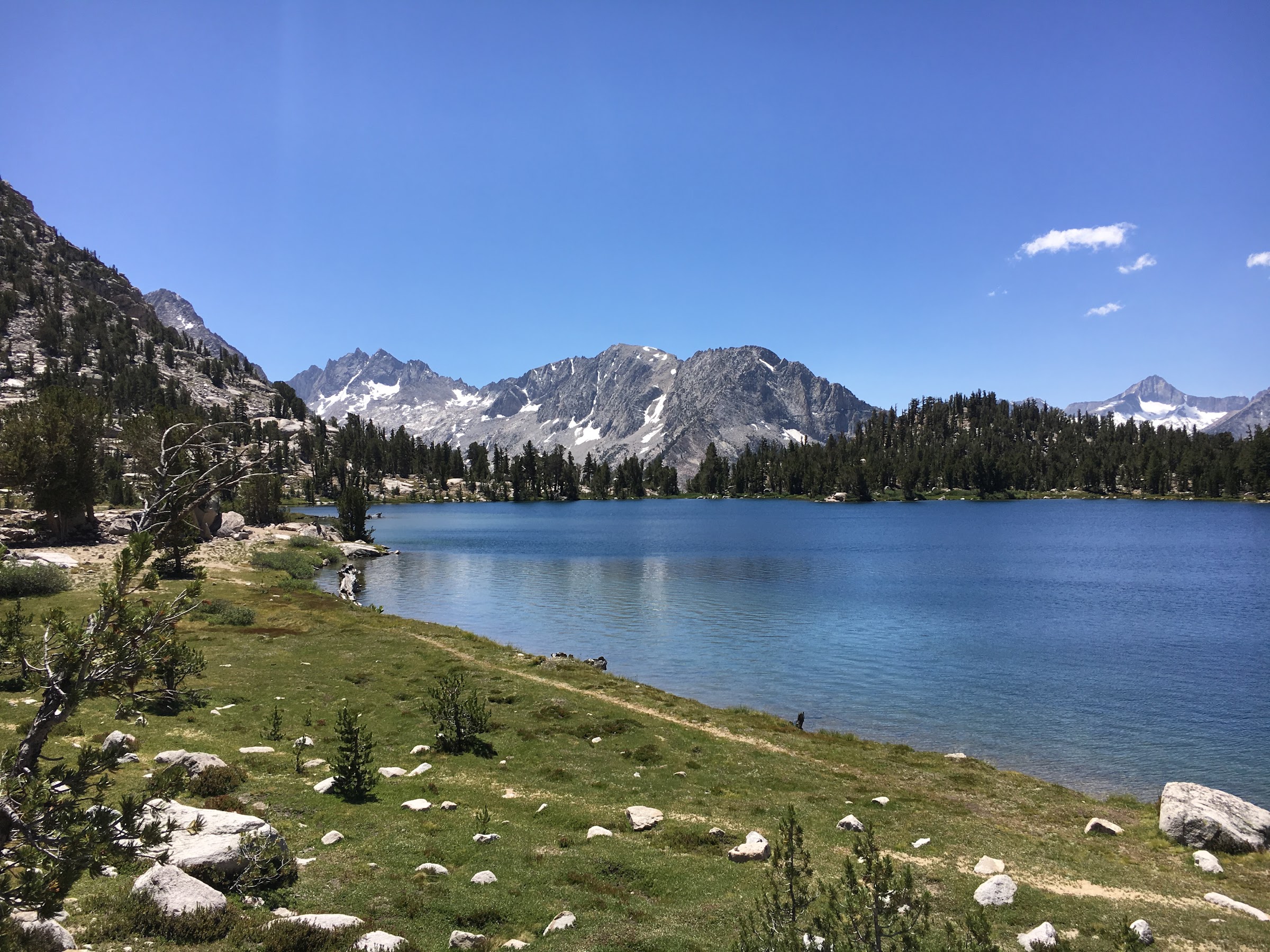
We pressed onwards, passing through what appeared to be an avalance path to a great campsite perched high on a bench above Bubbs Creek, just before the Center Basin trail junction.
Day 17: Center Basin to Wright Creek
We had a number of options for Day 17, but all of them involved climbing Forester Pass. At 13,153 feet, Forester is the highest point on the Pacific Crest Trail and the highest pass on the JMT (excluding Trail Crest on Mount Whitney). The climb up to the pass was tough with our heavy packs. Towards the top, lingering snow forced us off of the switchbacks and on to a use trail through talus. The final approach to the pass required crossing some snow fields, but like the previous passes, there was a solid boot pack the whole way.
The pass proper is more of a notch in a wall then a pass. The south side fell off precipitously; it was clear that this trail was more constructed than discovered. After a quick break, we headed south, entering the Tyndall Creek area that Matt and I had visited during a climb of Mount Tyndall two years before. We briefly considered climbing nearby Caltech Peak, but snow on the route and a desire to leave us a shorter next day led us to push onwards.
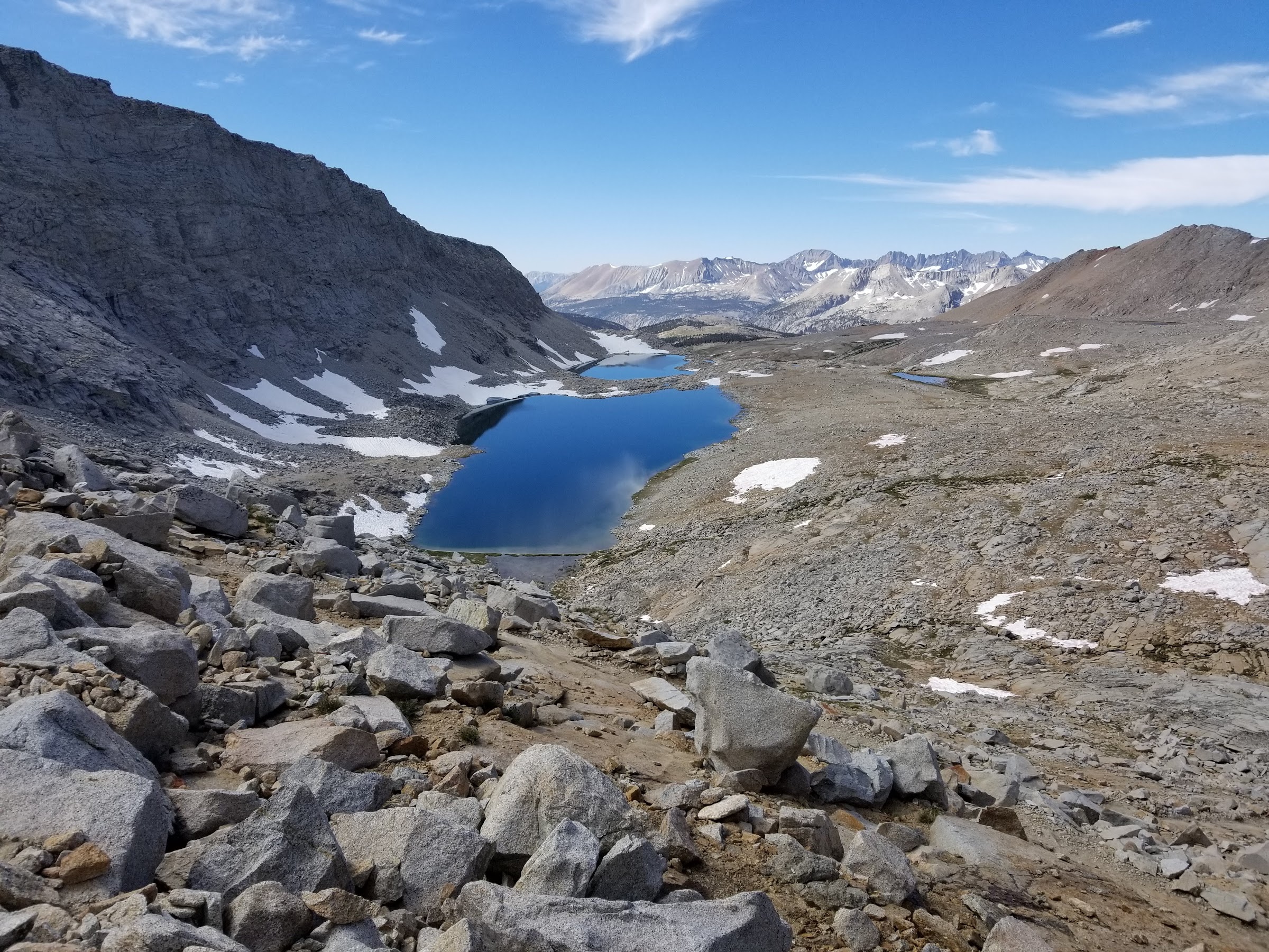
Descending the steep south face of Forester Pass
The best part of the day for me was the crossing of the Bighorn Plateau. This vast, treeless area affords incredible views of the Kaweah range. I’d love to come back here and spend more time exploring the empty expanse.

The sparse Bighorn Plateau with views west to the Kaweah Range
After a long day, we found camp just off the trail near Wright Creek, putting us in great position to tackle a few peaks the following day.
Day 18: Mount Barnard and Trojan Peak
Unlike all of our other days, on Day 18, we did not move camp. Instead, we set off cross-county, aiming to climb the almost-14er, Mount Barnard, and, if time and conditions allowed, Trojan Peak. The first order to business was attaining the southeast ridge of Mount Barnard. This we accomplished by along the south shore of Wright Creek until we could follow a tributary up to the base of ridge. A series of steps separate by sandy Class 1 slopes comprises the long, southeast ridge of Barnard. Though it took a long time to climb, the views south to Mount Russell and Mount Whitney more than made up for the difficulty. Until not too long ago, Mount Barnard was considerd to be a 14,000 foot mountain, and thus saw a large number of parties every year. Once it was downgraded to the tallest13er, the popularity waned substantially. We were the third party on the mountain in 2019.
Along the southeast ridge of Mount Barnard
From the summit of Barnard, we dropped down the terribly loose and crappy northeast face into the high bowl above George Creek. I had read epics of the bushwacking required to reach this bowl from far below to the east, and I was happy to have the easier task of descending in to it. After crossing the bowl, we climbing loose scree up to the top of Trojan Peak. From the top, we could gaze one-thousand feet down into the gnarly Williamson Bowl and one-thousand feet up to the summit of Mount Williamson. The West Chute route I had climbed on Willaimson the year prior was clearly visible.

Mount Williamson and Trojan Peak from the summit of Mount Barnard
Retracing our steps down Trojan Peak, across the bowl, and back up to Mount Barnard took a long time. I was quite tired at this point, and we still had to descend all the way back to camp. Luckily the immense beauty of the Wright Lakes basin gave me the extra boost needed to make it back. What a day!

Ethan hiking through the Wright Lakes Basin
Day 19: Wright Creek to Crabtree Meadow
Our adventure the day before had seriously sapped my energy, so we got off to a slow start. Over a few rolling miles, we worked our way south to the gates of the Mount Whitney area. We crossed the junction with the High Sierra Trail, and Matt and I reminisced about our trip on that trail back in 2012. After hiking for almost three weeks on the JMT, that trip now seemed like a walk in the park; funny how perspectives change.
We set up camp around noon at the ever-busy Crabtree Meadow. We had arrived early enough to snag a semi-private site and get some rest before the crowds started to arrive. In the afternoon, we convinced ourselves that we had enough energy to tackle a climb of Mount Hitchcock.
Hitchcock is the striking peak that all Mount Whitney hikers see when reaching Trail Crest. The easiest climb is from the west up a long Class 2 slope, which is where we headed. Unfortunately, I misread the topo, and we wandered around some cliff bands before making it to the west ridge proper. From here it was a long climb up loose scree. While not technically demanding, the fatigue from the day before made this one of the most difficult climbs for me.

Ethan taking a mandatory breather while climbing Mount Hitchcock
We perserved and eventually reached the summit, taking in views of the imposing west face of Mount Whitney and gazing south to the Mount Langely area. Our goal for the following day, Mount Young, looked like an easy climb.

Mount Whitney from the summit of Mount Hitchcock
Day 20: Crabtree Meadow to Guitar Lake
The camp at Crabtree had filled with tons of people, so we headed out early to beat the crowds up to Guitar Lake. We arrived before 10 am and had our choice of campsites. Back in 2012, Matt and I had climbed Mount Hale and were intending to climb Mount Young when a thunderstorm chased us off. Thus we were familiar with the approach to the broad chute up to Mount Young and Mount Hale.

Ethan on the summit of Mount Young with Guitar Lake far below
Matt gunned it straight up the talus and I followed a more circuitous route, but we both made it up in short order. It was about noon at this point, and the sun was blazing and hot. We headed back to camp and spent the afternoon napping and swimming in the freezing Guitar Lake to stay cool.

Matt and Ethan after a refeshing swim in Guitar Lake
Day 21: Guitar Lake to Whitney Portal
The last day on trail. We left camp around 5am, climbing most of the lower switchbacks in the morning twilight. We were strong after two weeks of the trail, and fully acclimatized to the altitude. Our pace was brisk, and we caught and passed almost everyone ahead of us. At Trail Crest we dropped our backpacks, carrying only water and snacks with us for the final two miles up to the summit of Mount Whitney.

The end of the trail atop the Mount Whitney
This was my fourth time to the top and Matt’s second, and we both felt great. We enjoyed the view of Mount Barnard, Trojan Peak, Mount Hitchcock, and Mount Young, and of all the ground we had covered in the previous five days.

Matt checking out the route up Mount Muir
Heading back, we made a brief detour up to the base of the Mount Muir summit block. Matt scrambled about a third of the way up, before we both decided that the climbing was a bit too far out of our comfort zone. This was my secound attempt on Muir; next time I’ll need to take someone who knows how to climb :-)
With nothing left to do, we returned to Trail Crest and began the crushing, nine mile descent back to Whitney Portal. Three weeks ago, I had set out from Horseshoe Lake in Mammoth and now here I was at Whitney Portal, all through my own power. Eleven summits, nine passes, and a lifetime of memories.

Mission Accomplished