on
Clark Range
The Clark Range
The Clark range is a north-south range set far to the west of the main Sierra crest in the southern part of Yosemite. It’s visibile from many places in the park, especially the stunning aretes of Mount Clark, yet I had never visited. That was about to change.
A Long Approach
I approached from the Mono Meadows trailhead off of Glacier Point Road. Oddly the first mile or so is a steep downhill to the meadows themselves. From there it’s another couple miles through regenerating forest down to the Illilouette Creek crossing. The elevation there is a mere 6,400ft making for a warm mid-day crossing.
From the creek, the route crossing beneath the imposing domes of Mount Starr King, another SPS peak, but one outside of my skillset; the easiest routes are all 5th class. The trail then begins a gentle ascent through the valley of Illilouette Creek. This area burned in the not too distant past and is still recovering. Not exactly my favorite area of the Sierra. The upper parts of the valley have more old growth forest and are much nicer.

Clark Range
By the time I reached the Merced Pass trail junction I was already quiet tired, but persisted on for a new few miles up to Lower Ottoway Lake. This was a good decision as I found an ideal site along the creek looking back west to the Buena Vista Crest and the central valley beyond.

Camp near Lower Ottoway Lake
Red Peak
I awoke early, eager to attempt Red Peak and a possible traverse from its summit over to Gray Peak and back. My first order of business was packing up and moving camp to Upper Ottoway Lake, a good 800ft climb. The campsites at Upper Ottoway are far rockier and not nearly as pleasant as those of the lower lake, but I found a decent spot, stashed my gear, and got ready to climb.

Lower Ottoway from Upper Ottoway
Secor suggests leaving the trail at 10,400ft and climbing talus more or less directly to the summit. I went a bit higher, perhaps 10,500ft, before striking off up the south face. The talus here is decently stable and well-sized; making for a straightforward if dull climb. This was the highest I had been in 2020, and I felt the altitude as I neared the summit.

South face, Red Peak
Once the ridge is gained, there is an astounding view north to the Cathedral range and east to the Ritter range. The high peaks of Yosemite are arrayed before those lucky enough to gain this vantage point. Nearby Red Peak Pass, the highest trail point in Yosemite, should also offer a comparable view.

High Peaks of Yosemite
From the summit of Red Peak, I gazed north across a high basin to Gray. While of similar height, to traverse over, I would need to drop off the summit, descend 1,000ft, and reclimb looser talus on the south face of Gray. To get back to camp, I’d have to retrace my steps over the summit of Red Peak. Wary of potential thunderstorms after a failed attempt on Mount Florence, two week prior, I decided to set my sights on Merced Peak to the south instead. The descent back to camp went quickly. Angling at bit closer to Red Peak Pass, but still staying way below the gendarmes on the ridge, one can find a steep scree chute making the descent easier.
Merced Peak
Back at camp, I ate lunch and topped off water before striking out towards Merced Peak, the high point of the Clark range. The immediate obstacle was getting around the lake. Cliffs to the east forced me around the west and south shores of the lake, sidehilling over lots of loose talus. The terrain improved, and I followed grassy slopes up to Snow Pass. From the pass the north ridge looked imposing, but just off the crest to the east there was an easy class 2 series of ledges leading up to the summit plateau.
North ridge, Merced Peak
As I was climbing, the clouds continued to build. I tagged the summit, signed the register, and immediately turned around. I followed the grassy slopes lower on the return, keeping east of a waterfall. The talus around the south shore at lake level was equally bad, and I disliked the traverse back around the lake. I made it back to camp just in time; about five minutes after I arrived the clouds burst. The storm lasted a good hour with a decent amount of thunder and lightning. I was very glad to be back at camp.
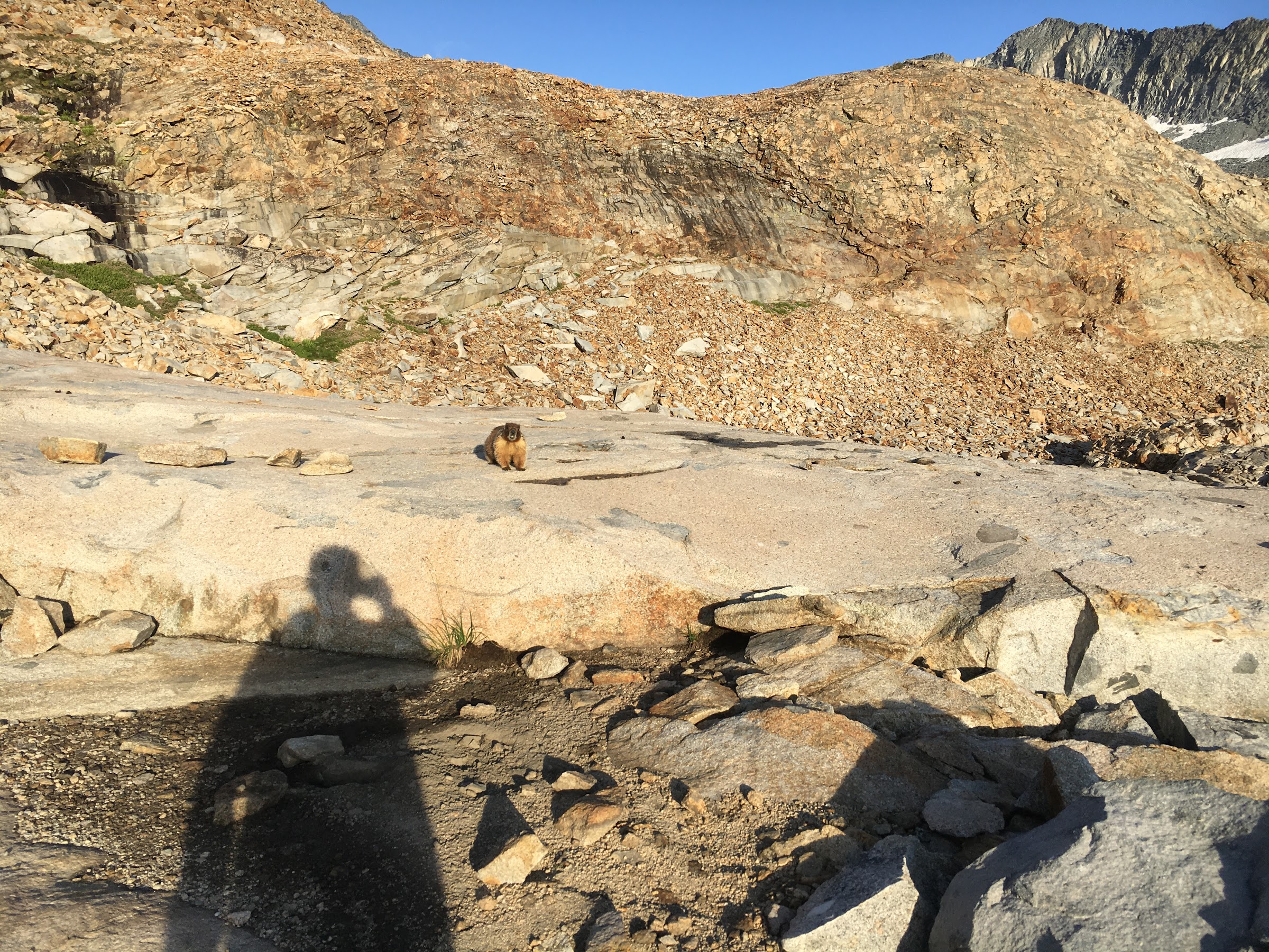
Camp visitor
After the storm, I became aware of a scratching noise nearby. I looked out from the tent and saw a marmot sniffing at some clothing I had left out. He gave no reaction to a shout, so I had to get up and chase him off. This would not be the last I saw of him. In fact, he and I had a standoff for the rest of the evening, keeping an appropriate social distance between us.
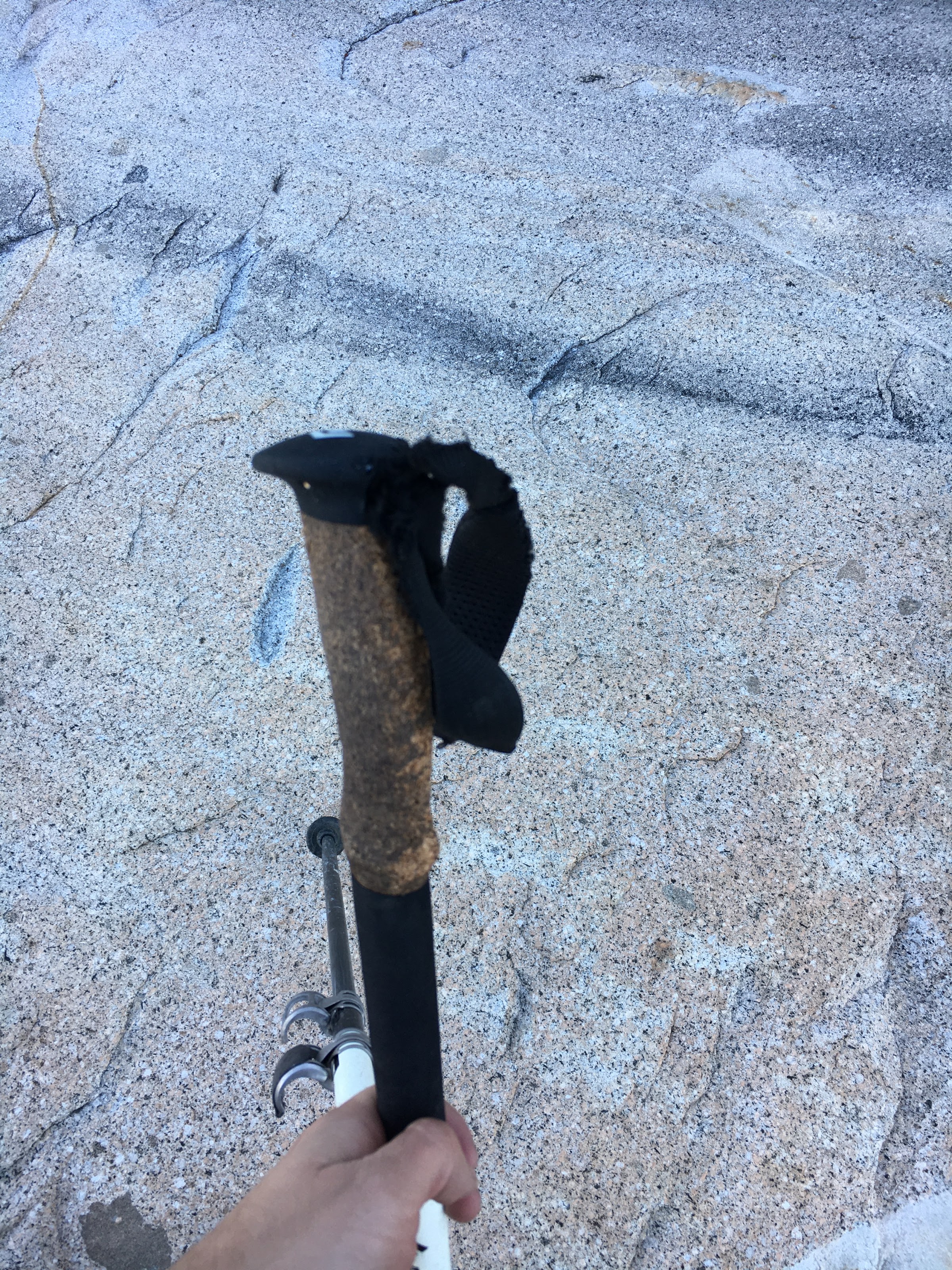
Camp visitor, the aftermath
When I awoke the next morning, to my horror, I discovered the marmot had the last laugh. Both of my trekking poles had been gnawed on. On one of the poles a decent amount of the cork was stripped and there were very clear teeth marks.
The hike out was long, the last two days had taken their toll on my feet. Near Gray Creek, an NPS ranger stopped me and did a permit and ID check; even a pandemic can’t stop the bureaucracy in Yosemite it seems.